the best e-tool for up-to-date overviews of land data
e-Cadastre enables users to easily view various spatial data attributes maintained by their government or corporation.
contact
- datel@datel.eu
company profile- visit website
e-cadastre

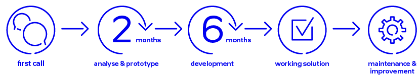
Estonian e-Cadastre example: Development took half a year!
Depending on the complexity of the cadastre system, software development can take from a few months to a few years. The cadastre project depends on the existence of local legislation, systems may not be the same nationwide, etc.
We are able to move data from one platform to another, e.g. from Oracle to Postgre, PostGIS. From ESRI to PostGIS. Our team uses open-source tools. We have developed our products on open-source platforms.
We work every day with Big Data, including satellite data. Through our partners, we offer also hardware solutions.
Estonian e-Cadastre example: Development took half a year!
KEY BENEFITS
- a centralized and up-to-date overview of all land data, including borders, building locations, ownership, etc. The whole state/county is managed in the same way with the same system. Among other things, it makes it easier to train people.
- reduces administrative burden, this speeds up procedures
- easier calculation of land and real estate worth
- enables calculation of land tax
- reduces costs of land data management
AWARDS
- 2016, 2015 Platforms of the United States Digital Counties Award Winner, developer
- 2015 Quality Innovation of the year in Estonian public sector category, developer
- 2010 Estonian State Land Information System (ESLIS) platform most advanced among 21 GIS portals in Europe
- 2010 ESRI Special Achievement in GIS award
references
- Estonian State Cadastral Information System
- Digital archive for the Estonian Land Board and for the Estonian Geology Service
- Estonian State Land Information System
- Montgomery County, Virginia, US I-GIS